TL;DR:
- Iceland's settlement from 874 to 930 CE was a complex process involving diverse origins and phased migration. The establishment of the Alþingi marked the transition from settlement to society, with about 1,500 farmsteads and a population possibly reaching 24,000. Archaeological evidence and DNA studies reveal that settlers came from multiple regions, including Celtic peoples, challenging the romanticized Norse freedom narrative.
The settlement of Iceland is defined as the process between roughly 874 and 930 CE when Norse settlers established the first permanent farms on the then largely uninhabited island, creating the foundation of Icelandic society. This was not a single wave of migration. It was a complex, decades-long process involving 400 principal settlers, diverse origins, geographic constraints, and a governance experiment that still echoes in Iceland's political culture today. If you want to understand Iceland, you start here.
What was the timeline of the settlement of iceland?
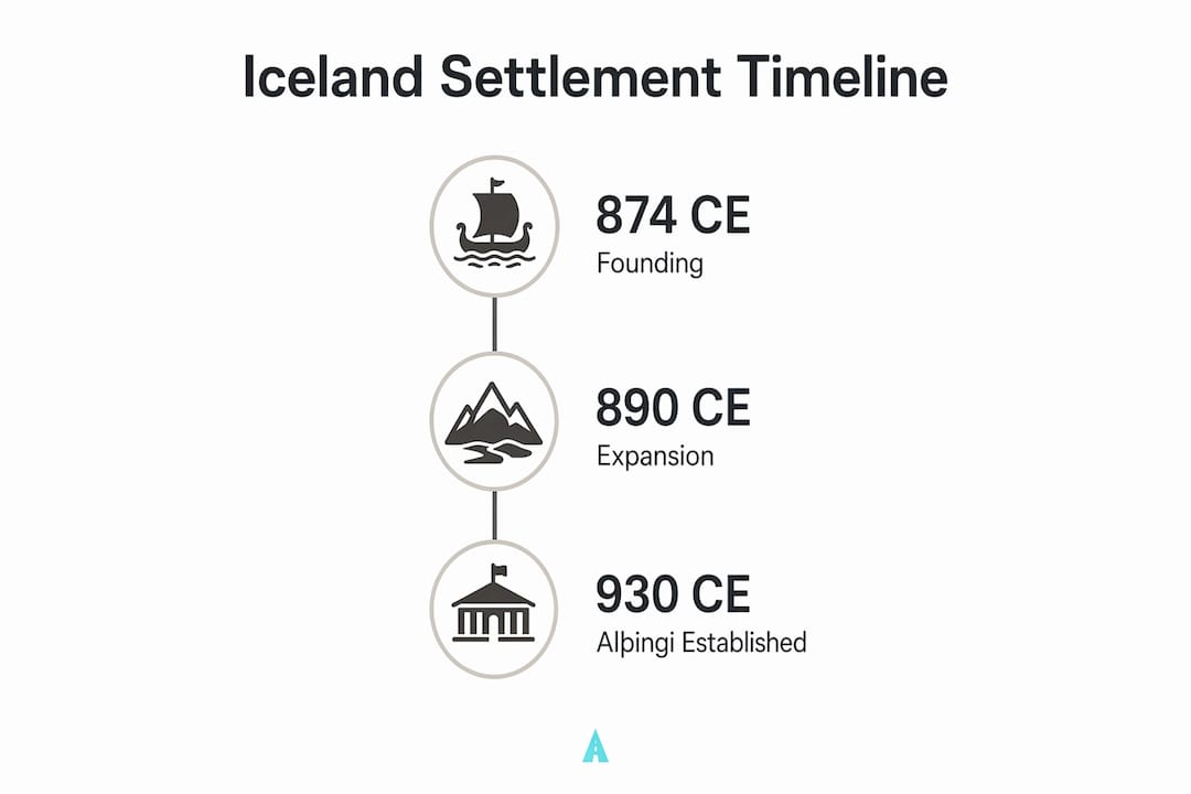
Iceland's permanent settlement spans roughly 56 years, from 874 CE to 930 CE. That endpoint is not arbitrary. The year 930 CE marks the establishment of the Alþingi, Iceland's national assembly, where chieftains gathered to recite laws and resolve disputes. That single institution signals the moment a collection of scattered farms became a functioning society.
The scale of what happened in those five decades is striking. Archaeological and historical records point to approximately 1,500 farmsteads established by the peak of settlement. Population estimates range widely, from 4,300 to as many as 24,000 people. That range reflects genuine uncertainty in the sources, not sloppy scholarship.
| Period | Key Development |
|---|---|
| ~874 CE | Ingólfr Arnarson traditionally credited as first permanent settler at Reykjavík |
| 874–900 CE | Primary wave of Norse and British Isles settlers claiming coastal lands |
| 900–930 CE | Secondary settlers fill remaining arable zones; farmstead numbers peak |
| ~930 CE | Alþingi established at Þingvellir, marking end of settlement era |
Pro Tip: If you visit Þingvellir National Park today, you are standing at the exact site where Iceland's first parliament met in 930 CE. The rift valley itself served as a natural amphitheater for the assembly.
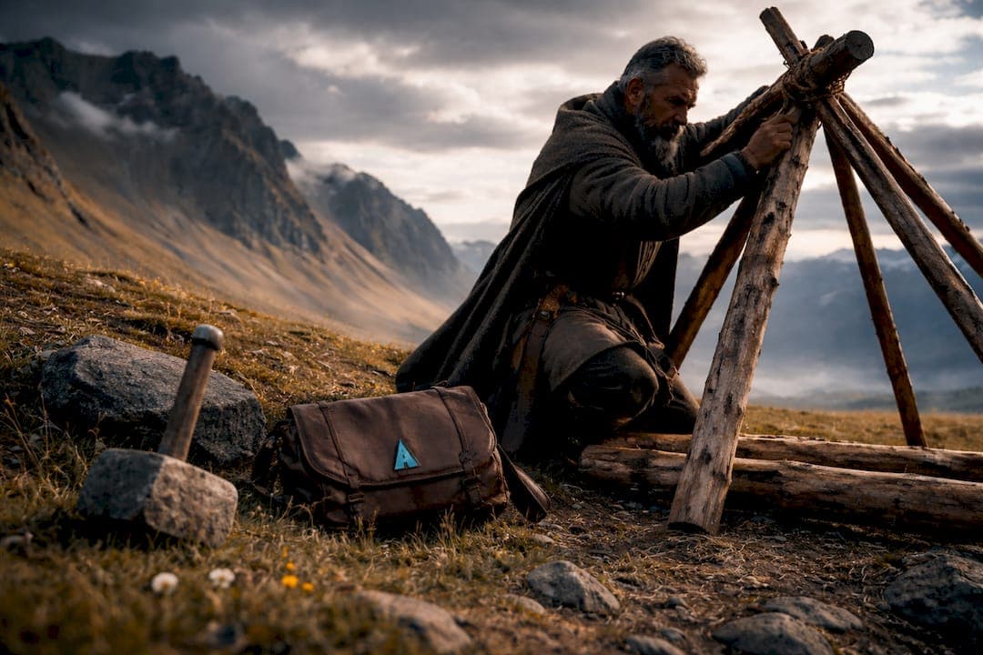
The settlement process was phased, not sudden. Early arrivals often occupied sites seasonally before committing to permanent farms. Think of it as a scouting period before full commitment. That pattern shows up clearly in the archaeological record, where temporary structures predate the more substantial longhouses associated with permanent occupation.
Who were the early settlers and how did they claim land?
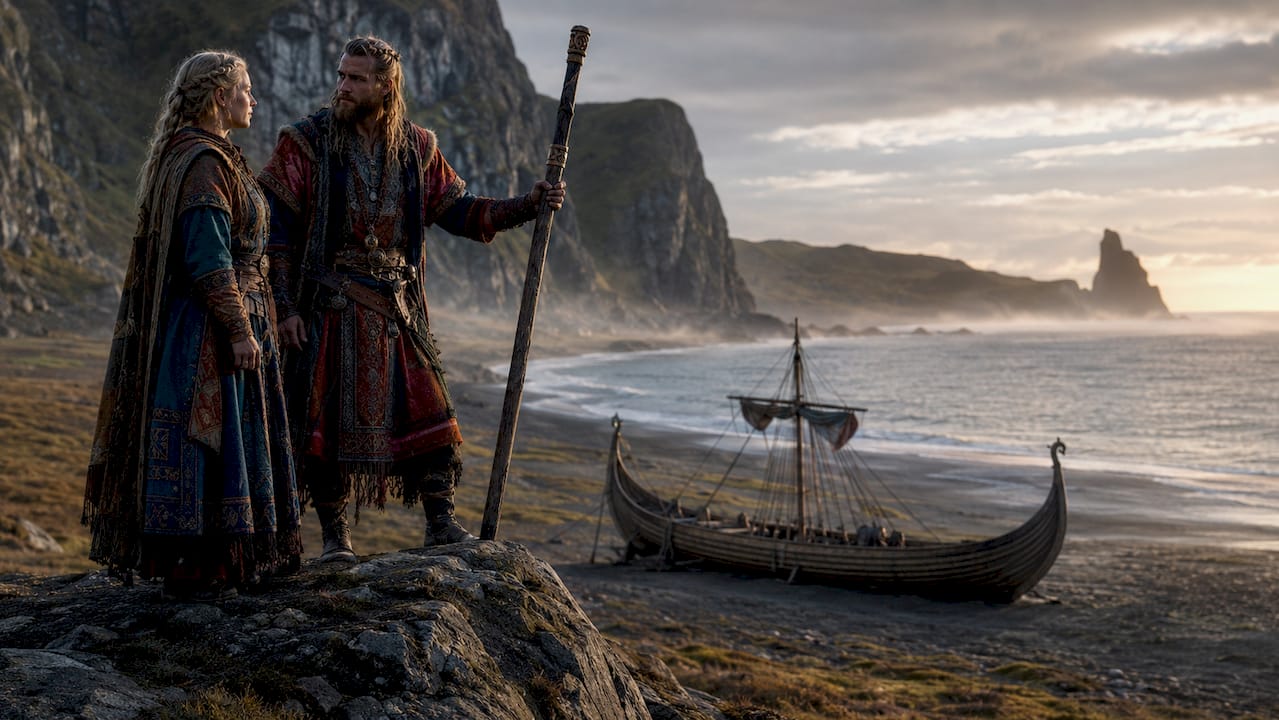
The traditional story casts the early settlers of Iceland as freedom-loving Norwegians fleeing the tyranny of King Harald Fairhair. Modern research dismantles that story. DNA studies confirm that settlers came from a diverse mix of Norwegians, Irish, Britons, and enslaved peoples. Trade networks, alliances, and forced migration all played roles. The "freedom seeker" narrative is a later political invention, not a historical fact.
The primary written source for understanding who settled Iceland is the Landnámabók, or "Book of Settlements." This document catalogues approximately 360–400 principal settlers and their land claims, arranged geographically and filled with genealogies and folklore. It reads more like a cultural document than a census. Historians treat it as a starting point, not a final answer.
Key characteristics of early Icelandic settlement patterns:
- Geographic clustering: Settlers concentrated on coastal lowlands with access to pasture, freshwater, and harbors. Interior highlands were left largely uninhabited.
- Social hierarchy: Principal settlers (called landnámsmenn) claimed large territories. Dependents, thralls (enslaved people), and later arrivals filled subordinate roles.
- Kinship networks: Land claims often followed family and alliance ties from Norway and the British Isles, not random individual choice.
- Mixed economy: Farming, fishing, and animal husbandry combined from the start. No single subsistence strategy dominated.
"The Landnámabók was compiled 200–300 years after settlement and reflects a 12th-century Christian worldview more than 9th-century reality. Treat it as a cultural artifact, not a literal record." — historians advise
The Alþingi itself grew directly from this settlement structure. The goðar, or chieftains, who controlled the largest land claims became the political class that ran the assembly. Land ownership and political power were the same thing in early Iceland.
How do archaeology and the sagas compare?
The Icelandic sagas are extraordinary literature. They are also unreliable history. Sagas were written 200–300 years after settlement, and they reflect the political and religious priorities of 12th and 13th-century Iceland, not the 9th century. Historians use them as cultural narratives, not literal accounts.
Archaeology provides the physical check on saga claims. The results are instructive.
| Source | Farmstead Count (Skagafjörður Region) | Reliability |
|---|---|---|
| Saga accounts | 22 farms | Cultural narrative; compiled centuries later |
| Archaeological excavations | 17–20 farms | Physical evidence; subject to preservation limits |
The Skagafjörður excavations show a modest but real discrepancy between saga claims and physical evidence. That gap is not a scandal. It is exactly what you would expect when oral traditions get written down generations later. The sagas inflate prestige and lineage. Archaeology counts what actually survived in the ground.
DNA analysis adds another layer. Genetic studies show that female settlers had significantly higher proportions of Celtic ancestry than male settlers. That finding points directly to the role of enslaved women from Ireland and Britain in Iceland's founding population. The settler origins were complex, and the demographic picture is far richer than any saga tells you.
Pro Tip: The Settlement Exhibition (Landnámssýningin) in Reykjavík displays an excavated Viking Age longhouse dating to around 871 CE. It is one of the best places to see the physical reality of early Icelandic settlement up close.
Archaeology and sagas work best together. The sagas give you names, motivations, and cultural meaning. Archaeology gives you dates, structures, and demographics. Neither source alone tells the full story.
How did geography shape icelandic settlement patterns?
Iceland's terrain is not hospitable to farming. Roughly 80% of the island is uninhabitable: glaciers, lava fields, and volcanic highlands cover most of the interior. Settlers had no choice but to concentrate in specific zones. Geography forced settlement into coastal lowlands with pasture, freshwater access, and harbor proximity.
That constraint shaped everything that followed. Here is how geographic factors drove specific settlement outcomes:
- Coastal concentration: The best farmland sat along the southwestern, western, and northern coasts. These areas received the most settlers and became the political and economic centers of early Iceland.
- Territorial competition: With arable land limited, the best plots were claimed fast. Disputes over prime agricultural land likely drove the need for a formal legal assembly, contributing directly to the Alþingi's creation.
- Climate sensitivity: Early settlers benefited from a relatively mild climate in the 9th and 10th centuries. Later cooling in the medieval period forced economic shifts toward fishing and reduced the viability of grain farming.
- Isolation as protection: Iceland's remoteness from mainland Europe meant settlers developed a distinct legal and cultural system with minimal outside interference. That isolation preserved Old Norse language and traditions longer than anywhere else in Scandinavia.
- Lasting transport challenges: The same geographic constraints that shaped Viking Age settlement still affect Iceland today. Transportation remains concentrated along coastal routes, and the interior is accessible only seasonally. The Iceland history timeline shows how these geographic realities have shaped every major era of Icelandic development.
The southwestern corner of Iceland, where Reykjavík now stands, was not chosen randomly. Ingólfr Arnarson's legendary settlement there reflects real geographic logic: sheltered harbor, geothermal warmth, and access to both marine and agricultural resources. Modern Iceland's capital sits where it does because a 9th-century settler made a practical decision about land quality.
Key takeaways
The settlement of Iceland between 874 and 930 CE was a geographically constrained, demographically diverse process that produced both the Alþingi assembly and a cultural identity still visible in Iceland today.
| Point | Details |
|---|---|
| Settlement timeline | Iceland was settled between 874 and 930 CE, ending with the Alþingi's establishment. |
| Scale of settlement | Roughly 400 principal settlers established up to 1,500 farmsteads at peak occupation. |
| Diverse origins | Settlers came from Norway, Ireland, Britain, and included enslaved peoples, confirmed by DNA studies. |
| Sagas vs. archaeology | Sagas were written 200–300 years later; archaeology provides the physical check on their claims. |
| Geography as destiny | Coastal lowlands with pasture and harbor access determined where settlement succeeded or failed. |
What the sagas got wrong (and right): a closer look
I have spent years reading about Icelandic history, and the single biggest misconception I keep encountering is the idea that the settlement was a clean, heroic story of Norse freemen building a new world. That version is satisfying. It is also wrong in important ways.
The freedom narrative served a political purpose in medieval Iceland. When the sagas were written down in the 12th and 13th centuries, Iceland was under pressure from Norwegian royal authority. Emphasizing the settlers' independence from Norwegian kings was a way of asserting Icelandic sovereignty in the present, not just recording the past. The Landnámabók is partly a legal and political document dressed up as history.
What archaeology keeps revealing is the messiness underneath the heroic story. Enslaved people built many of those first farmsteads. Women from Ireland and Britain, brought by force, became the genetic mothers of a significant portion of the Icelandic population. The Icelandic naming traditions that survive today carry traces of this mixed heritage in ways most people never notice.
The part the sagas got right is cultural meaning. They preserved the memory of specific people, places, and decisions in extraordinary detail. When you stand at a site mentioned in the sagas, the text gives you a human connection that no excavation report can replicate. The best approach is to hold both sources at once: the physical evidence and the cultural story. Neither is complete without the other.
— Sergiu
Explore iceland's settlement sites with Easytransfer
Iceland's settlement history is not locked in books. You can walk through it. From the excavated longhouse at the Settlement Exhibition in Reykjavík to the dramatic rift valley at Þingvellir where the Alþingi first met, the physical sites of early Iceland are accessible and genuinely moving.
Getting between these landmarks is where Easytransfer makes your trip easier. Easytransfer offers private transfers across Iceland with fixed pricing, no hidden fees, and vehicles ranging from Tesla electric cars to Mercedes models for larger groups. Whether you are arriving at Keflavík Airport and heading straight to Reykjavík or planning a day trip to Þingvellir, Easytransfer handles the logistics so you can focus on the history. Book your transfer, get instant confirmation, and travel with a driver who knows the country. Your exploration of Iceland's past deserves a reliable ride.
FAQ
When did the settlement of iceland begin and end?
Iceland's settlement is traditionally dated from 874 CE, when Ingólfr Arnarson established the first permanent farm near modern Reykjavík, to 930 CE, when the Alþingi assembly was founded at Þingvellir.
How many people settled iceland during the viking age?
Population estimates for the settlement period range from 4,300 to 24,000 people, with approximately 400 principal settlers recorded in the Landnámabók and up to 1,500 farmsteads established at peak settlement.
Were all early settlers of iceland norwegian?
No. DNA studies confirm that settlers came from Norway, Ireland, Britain, and included enslaved peoples with Celtic ancestry. The idea that Iceland was settled exclusively by freedom-seeking Norwegians is a later political narrative, not historical fact.
What is the landnámabók and how reliable is it?
The Landnámabók is a medieval Icelandic document cataloguing roughly 360–400 principal settlers and their land claims. It was compiled 200–300 years after the settlement period and reflects 12th-century political and Christian perspectives, so historians treat it as a cultural source rather than a precise census.
How does iceland's geography still affect the country today?
The same coastal lowlands that attracted the first settlers remain Iceland's most populated zones today. Geographic constraints on arable land and transport routes established during the Viking Age settlement continue to shape where Icelanders live and how they move around the island.