TL;DR:
- Iceland's volcanic activity results from the combined forces of the Mid-Atlantic Ridge and a mantle hotspot. Its volcanoes significantly shape the landscape, culture, and tourism, with some eruptions causing immediate hazards like ash clouds and glacial floods. Visitors must stay informed and follow safety guidelines to safely experience and observe Iceland's dynamic volcanic environment.
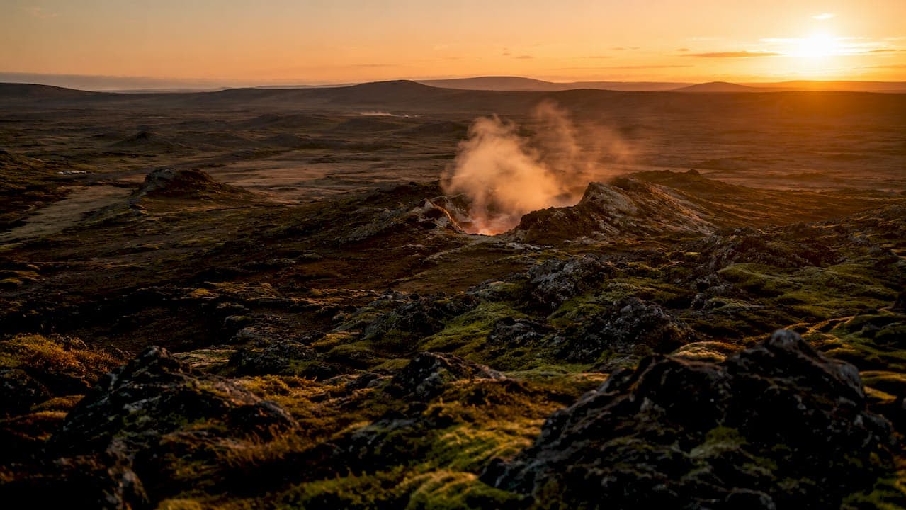
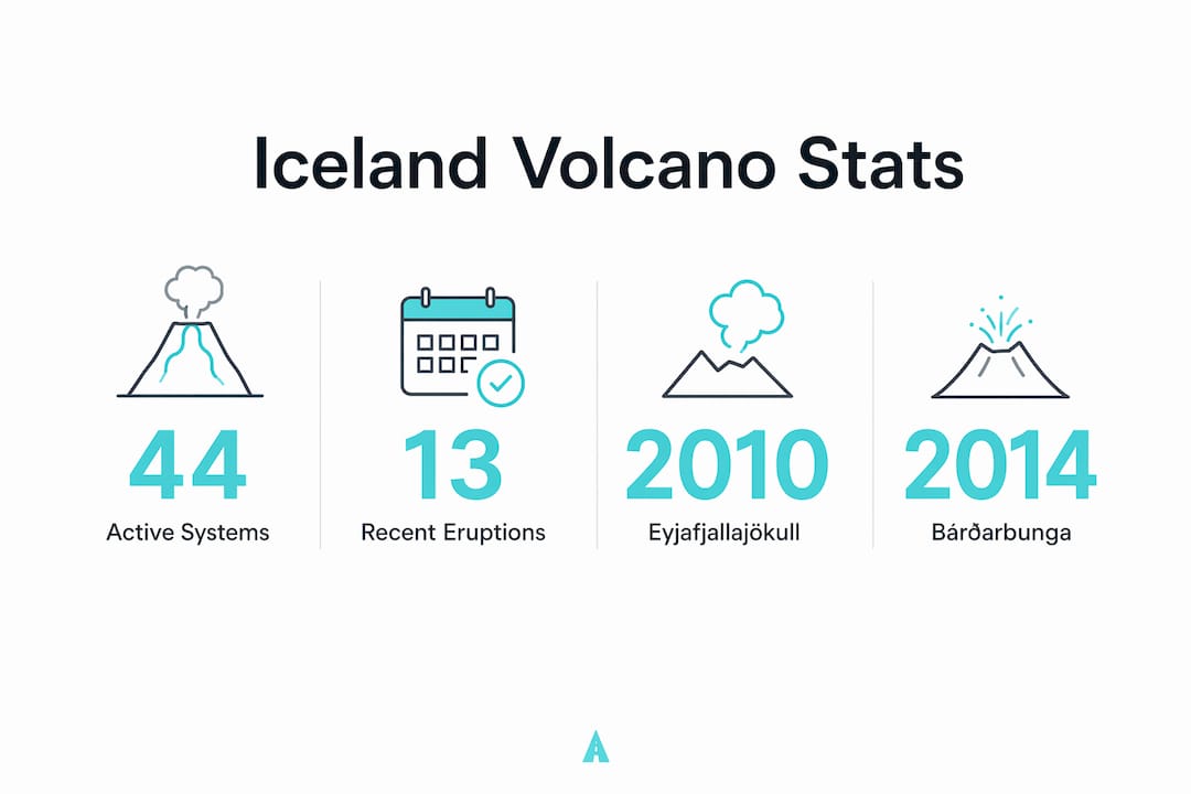
Iceland is defined by its position on both the Mid-Atlantic Ridge and a mantle hotspot, making it one of the most volcanically active places on Earth. The island holds around 130 volcanic mountains and 44 active volcanic systems, with about 13 erupting since 1900. That level of activity shapes everything here: the land, the culture, the air you breathe, and the tours you can book. Whether you are planning a family trip or studying Icelandic geology, these iceland volcanoes facts will give you a clear, honest picture of what to expect.
What geological processes create Iceland's volcanoes?
Iceland sits at the junction of two massive tectonic forces. The Mid-Atlantic Ridge is a divergent plate boundary where the North American and Eurasian plates pull apart at roughly 2.5 centimeters per year. That spreading creates constant fractures in the crust, allowing magma to rise. Iceland is also positioned directly above a mantle hotspot, a fixed column of superheated rock rising from deep within the Earth. The combination of both forces is rare above sea level and explains why Iceland produces so much volcanic activity.
The hotspot amplifies what the ridge alone would create. Where most mid-ocean ridges produce underwater volcanoes, Iceland's hotspot pushes enough material to the surface to build an island. The result is a landscape that is literally growing. Geologists describe Iceland as one of the only places on Earth where you can observe active plate tectonics above sea level.
This dual mechanism produces several distinct volcano types:
- Fissure volcanoes: Long cracks in the ground that erupt lava in curtain-like sheets. The Laki eruption of 1783 is the most famous example.
- Shield volcanoes: Broad, gently sloping mountains built from repeated lava flows. Skjaldbreiður is a textbook example.
- Stratovolcanoes: Steep, cone-shaped peaks built from alternating layers of ash and lava. Hekla and Eyjafjallajökull fall into this category.
- Subglacial volcanoes: Volcanoes buried beneath glaciers. Grímsvötn and Katla are the most significant.
Pro Tip: If you want to see active plate spreading with your own eyes, visit Þingvellir National Park. You can walk directly between the North American and Eurasian plates in a rift valley.
Which are the major volcanoes in Iceland and how do they differ?
Iceland's volcanic systems each have a distinct personality. Understanding the differences helps you appreciate the geology and plan your visit more safely.
| Volcano | Type | Last Major Eruption | Key Fact |
|---|---|---|---|
| Grímsvötn | Subglacial | 2011 | Most active; about 70 eruptions in 1,100 years |
| Katla | Subglacial | 1918 | Overdue; closely monitored for large explosive eruption |
| Hekla | Stratovolcano | 2000 | Known as the "Gateway to Hell" in medieval folklore |
| Bárðarbunga | Subglacial/Fissure | 2014–2015 | Produced the largest lava flow in Iceland in 200 years |
| Eyjafjallajökull | Stratovolcano | 2010 | Ash cloud grounded over 100,000 flights across Europe |
Grímsvötn is the undisputed record holder for eruption frequency. Sitting beneath the Vatnajökull ice cap, it averages an eruption every 10–15 years and triggers glacial floods with almost every event. Its subglacial location means eruptions melt ice rapidly, sending enormous volumes of water across the surrounding plains.
Katla is the volcano Icelandic scientists watch most closely. It last erupted in 1918 and has been building pressure since. The longer a volcano like Katla stays quiet, the more energy accumulates. Scientists warn that its next eruption could be explosive and large-scale.
Eyjafjallajökull became globally famous in 2010 when its ash cloud shut down European airspace for weeks. The eruption itself was moderate by Icelandic standards. The disruption showed how far-reaching the effects of Icelandic volcanic eruptions can be, even for travelers thousands of miles away.
Bárðarbunga's 2014–2015 fissure eruption at Holuhraun produced lava fields covering an area larger than Manhattan. It was the largest eruption in Iceland since Laki in 1783 and released significant amounts of sulfur dioxide into the atmosphere.
How do eruptions impact the environment and communities in Iceland?
Volcanic eruptions in Iceland produce four main categories of impact: lava flows, ash clouds, glacial floods, and long-term landscape change. Each carries different risks for residents and visitors.
- Ash clouds can ground flights, reduce visibility to near zero, and damage aircraft engines. The 2010 Eyjafjallajökull eruption disrupted air travel across Europe for weeks, affecting millions of passengers.
- Glacial floods (jökulhlaups) are the most immediately dangerous effect of subglacial eruptions. When a volcano beneath a glacier erupts, it melts ice rapidly. The resulting flood can carry boulders, ice blocks, and debris across roads and farmland within hours.
- Lava flows move slowly enough that evacuation is usually possible, but they permanently alter the land. The Reykjanes Peninsula eruptions since 2021 have buried roads and infrastructure under fresh lava.
- Sulfur dioxide emissions from large fissure eruptions can cause respiratory problems and acid rain across wide areas. The 1783 Laki eruption released enough sulfur dioxide to cause crop failures across Europe and contributed to famine in Iceland.
"Visitors near Katla or Grímsvötn should familiarize themselves with emergency signage and evacuation routes before entering the area." — Icelandic safety guidance on jökulhlaup risks
Long-term, volcanic deposits actually benefit Iceland's soil. Basaltic ash breaks down into mineral-rich earth that supports vegetation. Iceland's geothermal fields, fed by the same volcanic heat, power homes and greenhouses across the country. The land is shaped by destruction and renewal in equal measure.
What safety considerations and viewing opportunities exist for tourists?
Volcanic activity in Iceland ranges from genuinely dangerous to relatively safe for viewing, depending on the eruption type. The key distinction is between explosive and effusive eruptions.
Reykjanes Peninsula eruptions since 2021 have been primarily effusive, meaning lava flows rather than explosive blasts. That makes them safer to observe from authorized viewing areas. Explosive eruptions, like those from Katla or a future Hekla event, produce ash columns, pyroclastic material, and glacial floods that require immediate evacuation.
Eruption warning times vary significantly. Scientists note that warning times can range from 20 minutes to over 4 hours depending on the volcano and monitoring data available. That window is short. Relying on real-time updates from the Icelandic Meteorological Office is the only reliable approach.
Practical safety rules for visitors:
- Check the Icelandic Meteorological Office website before entering any volcanic zone. It publishes live hazard maps and exclusion zone boundaries.
- Never cross a closed road or barrier. Exclusion zones exist because conditions can change within minutes.
- Know the evacuation routes before you arrive, especially near Katla and Grímsvötn.
- Travel with a guide for remote volcanic areas. Local guides carry emergency equipment and know the terrain.
Pro Tip: For guided volcano tours in 2026, book with operators who provide real-time safety briefings and carry satellite communication devices. This is especially important on the Reykjanes Peninsula, where conditions can shift quickly.
The Svartsengi and Sundhnúkur volcanic system on the Reykjanes Peninsula has accumulated over 26 million cubic meters of magma since august 2025, with ground uplift of about 2 centimeters per month. That data signals continued eruption potential in 2026. Staying informed is not optional when visiting this area.
How has volcanic activity shaped Iceland's culture and tourism?
Volcanoes are woven into Iceland's identity at every level. Medieval Icelanders called Hekla the "Gateway to Hell" and believed it was an entrance to the underworld. That folklore reflected genuine fear of a volcano that erupted frequently and violently. Today, that same fear has transformed into fascination, and tourism has followed.
Key ways volcanic activity shapes Icelandic life and travel:
- Geothermal energy: Iceland generates the majority of its electricity and home heating from geothermal sources powered by volcanic heat. The Blue Lagoon and Sky Lagoon, two of Iceland's most visited attractions, exist because of geothermal water.
- Tourism growth: Volcano-focused tours have grown significantly since the Reykjanes eruptions began in 2021. Visitors can now walk on lava fields that formed within the past few years.
- Landscape identity: Iceland's black sand beaches, lava tube caves, and geothermal hot springs all result from volcanic processes. These features define Iceland's appeal as a travel destination.
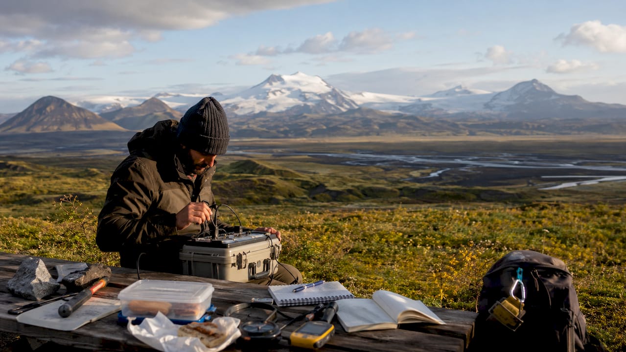
- Scientific research: Iceland hosts research stations and monitoring networks that attract geologists and volcanologists from around the world.
Volcanic activity shapes Iceland's sustainable development too. Geothermal power reduces Iceland's dependence on fossil fuels and supports greenhouse agriculture in a country with limited growing seasons. The same forces that create risk also create resilience.
Key takeaways
Iceland's 44 active volcanic systems, formed by the Mid-Atlantic Ridge and a mantle hotspot, make it one of the most geologically dynamic places on Earth, requiring both curiosity and caution from every visitor.
| Point | Details |
|---|---|
| Dual geological cause | Iceland's volcanoes result from both the Mid-Atlantic Ridge and a mantle hotspot acting together. |
| Grímsvötn leads in activity | With about 70 eruptions in 1,100 years, Grímsvötn is Iceland's most frequently erupting volcano. |
| Katla poses the greatest risk | Katla has not erupted since 1918 and its next eruption is expected to be large and explosive. |
| Effusive vs. explosive matters | Reykjanes lava flows allow safer viewing; subglacial eruptions require immediate evacuation. |
| Monitoring is non-negotiable | Warning times can be as short as 20 minutes, making real-time official alerts critical for safety. |
What I have learned watching Iceland's volcanoes up close
By Sergiu
Most visitors arrive in Iceland thinking volcanoes are a backdrop. They are not. They are the main event, and they do not follow a schedule. What strikes me every time I travel through the Reykjanes Peninsula is how quickly the landscape changes. Roads that existed last year are buried under lava. New land is forming while you stand on it. That is not a metaphor. It is geology happening in real time.
The mistake I see travelers make most often is treating volcanic zones like scenic overlooks. They drive up, step out, take a photo, and leave without reading a single warning sign. The danger of jökulhlaups near subglacial volcanoes is real and fast-moving. A flood triggered by a subglacial eruption can reach a road in under an hour. You will not outrun it if you are not already moving.
My honest view is that Iceland's volcanoes offer something genuinely rare: the chance to see the Earth building itself. That opportunity is worth pursuing. But it requires preparation, not just enthusiasm. Check the Icelandic Meteorological Office before every excursion. Travel with a guide in unfamiliar areas. And read the essential Iceland travel tips before you go, not after you land.
— Sergiu
Getting to Iceland's volcanic regions safely with Easytransfer
Reaching Iceland's volcanic areas requires reliable transport, especially when conditions change quickly and roads near active zones can close without notice.
Easytransfer provides private transfers across Iceland, including routes to the Reykjanes Peninsula, Vatnajökull, and other volcanic regions. Vehicles include premium Mercedes models and electric options like Tesla, all equipped with free WiFi. Flight tracking and fixed pricing mean no surprises on arrival. For families and groups, fleet options accommodate up to 49 passengers. If you are planning a volcano excursion in 2026, book your private transfer in Iceland with Easytransfer and travel with confidence. Get a quote by entering your pickup and drop-off locations, and a sales agent will respond within 24 hours.
FAQ
How many active volcanoes does Iceland have?
Iceland has 44 active volcanic systems, with about 13 erupting since 1900. The historic average eruption frequency is every 4–5 years, though recent Reykjanes activity has increased that rate.
Why does Iceland have so many volcanoes?
Iceland sits on both the Mid-Atlantic Ridge and a mantle hotspot. That combination produces far more volcanic activity than either force would generate alone.
Is it safe to visit Iceland's volcanoes in 2026?
Effusive lava flow eruptions on the Reykjanes Peninsula are generally safe to view from authorized areas. Subglacial volcanoes like Katla and Grímsvötn carry higher risk. Always check the Icelandic Meteorological Office for current exclusion zones before visiting.
What is a jökulhlaup and why does it matter for tourists?
A jökulhlaup is a glacial flood triggered when a subglacial volcano melts ice rapidly. These floods can occur with little warning and pose serious risks near Katla and Grímsvötn. Knowing evacuation routes before you arrive is critical.
Which Iceland volcano is most likely to erupt next?
Katla and the Svartsengi/Sundhnúkur system on the Reykjanes Peninsula are the most closely watched in 2026. Katla has not erupted since 1918 and scientists consider it overdue for a significant eruption.